US English


7 Engineering Geologist - Dam and Levee Projects Resume Templates with Example
By Ria · Last Updated On October 22, 2026
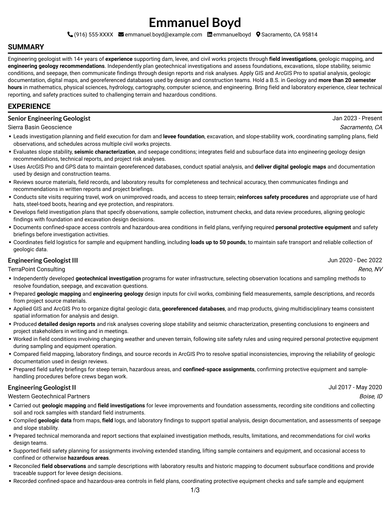
Resume example — page 1

This guide shows you how to build an Engineering Geologist - Dam and Levee Projects resume that clearly presents your fit for the work. Learn how to organize your evidence so employers can quickly review your field investigations, technical reporting, and engineering geology experience.

Strong resumes connect investigation work to project needs. Use clear sections and concise bullet points to show how you plan geotechnical investigations, assess foundations, excavations, slope stability, seismic conditions, and seepage, and communicate findings through design reports and risk analyses.

Explore one Engineering Geologist - Dam and Levee Projects resume example presented in 7 layouts. Compare the PNG image previews, then open an example in the editor to review its structure and customize it.

What Makes a Great Engineering Geologist - Dam and Levee Projects Resume in 2026

A strong resume uses clear section headings and focused bullet points to show investigation planning, geologic mapping, design recommendations, and safety practices. Put the most relevant experience where readers can find it quickly.

Use job-related terms naturally, such as GIS, ArcGIS Pro, spatial analysis, georeferenced databases, slope stability, seismic characterization, and seepage evaluation. Support them with specific examples from your work, reports, and field activities.

Note: Resume examples are for educational purposes only. Use only information that accurately reflects your experience and qualifications. References to real organizations do not imply affiliation or endorsement.

#1 Simple One Column Format Resume Example

The Simple One Column Format keeps resume content in one vertical reading path, a practical choice for readers who prefer sections in sequence.
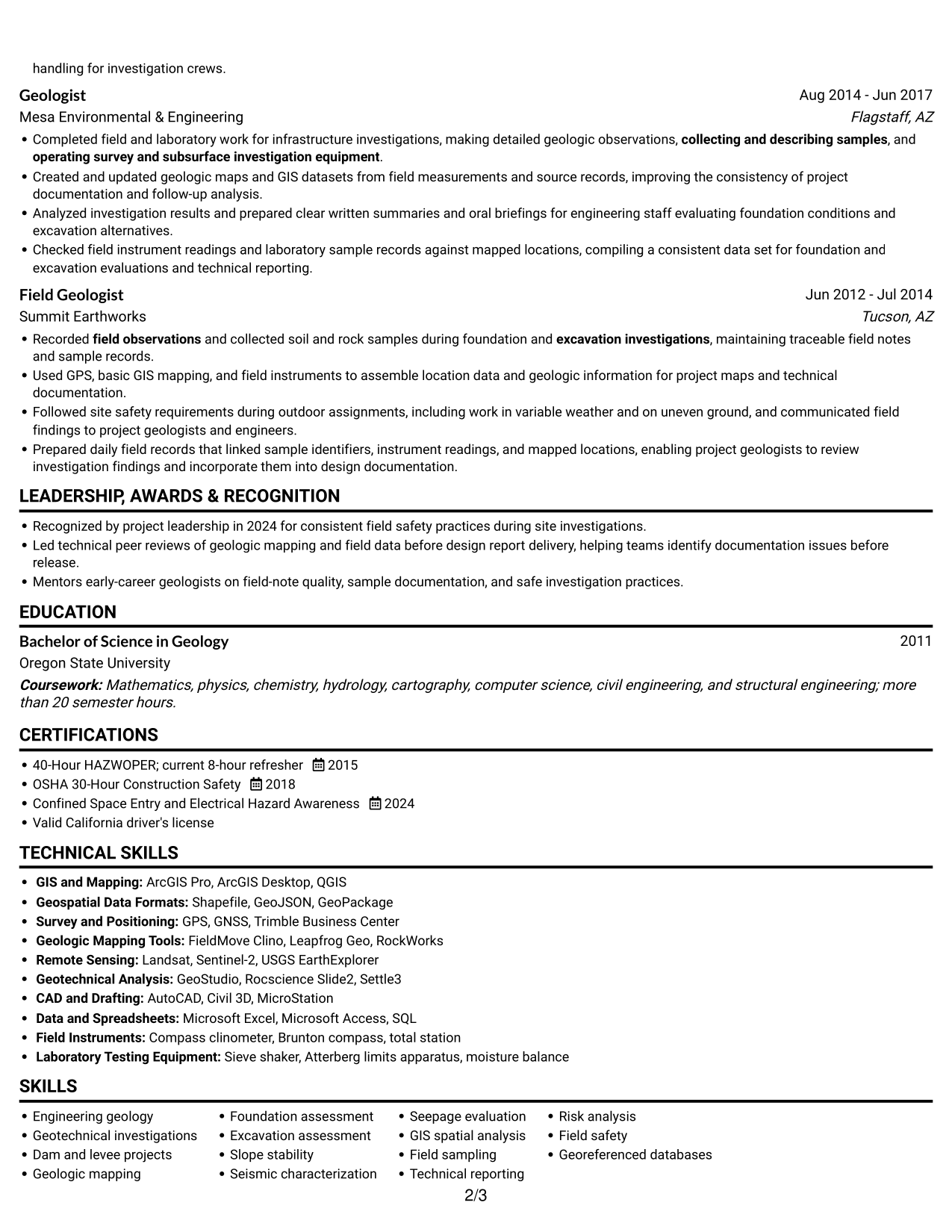
 
Resume example — page 1   Resume example — page 2

Why This Format Works

  • Career history stays in sequence, helping reviewers follow professional progression.
  • A single body column keeps experience details together for a focused review.
  • Skills, education, and credentials fit into one continuous reading path.

Best For

  • Single-path section review
  • Chronological experience records
  • Detailed experience bullets
  • Straightforward resume navigation
  • Full-width text preference

Resume Keywords

  • Bachelor of Science in Geology
  • more than 20 semester hours
  • 14+ years of experience supporting dam, levee, and civil works projects
  • Independently developed geotechnical investigation programs for water infrastructure, selecting observation locations and sampling methods to resolve foundation, seepage, and excavation questions.
  • geologic mapping
  • Prepared geologic mapping and engineering geology design inputs for civil works
  • Apply GIS and ArcGIS Pro to spatial analysis, geologic documentation
  • Dam and levee projects
  • field investigations
  • Leads investigation planning and field execution for dam and levee foundation
  • excavation investigations
  • Evaluates slope stability
  • seismic characterization
  • Seepage evaluation
  • engineering geology recommendations
See all keywords
 

#2 Simple Two Column Format Resume Example

The Simple Two Column Format arranges resume content in two columns, helping readers move between sections in a compact side-by-side view.
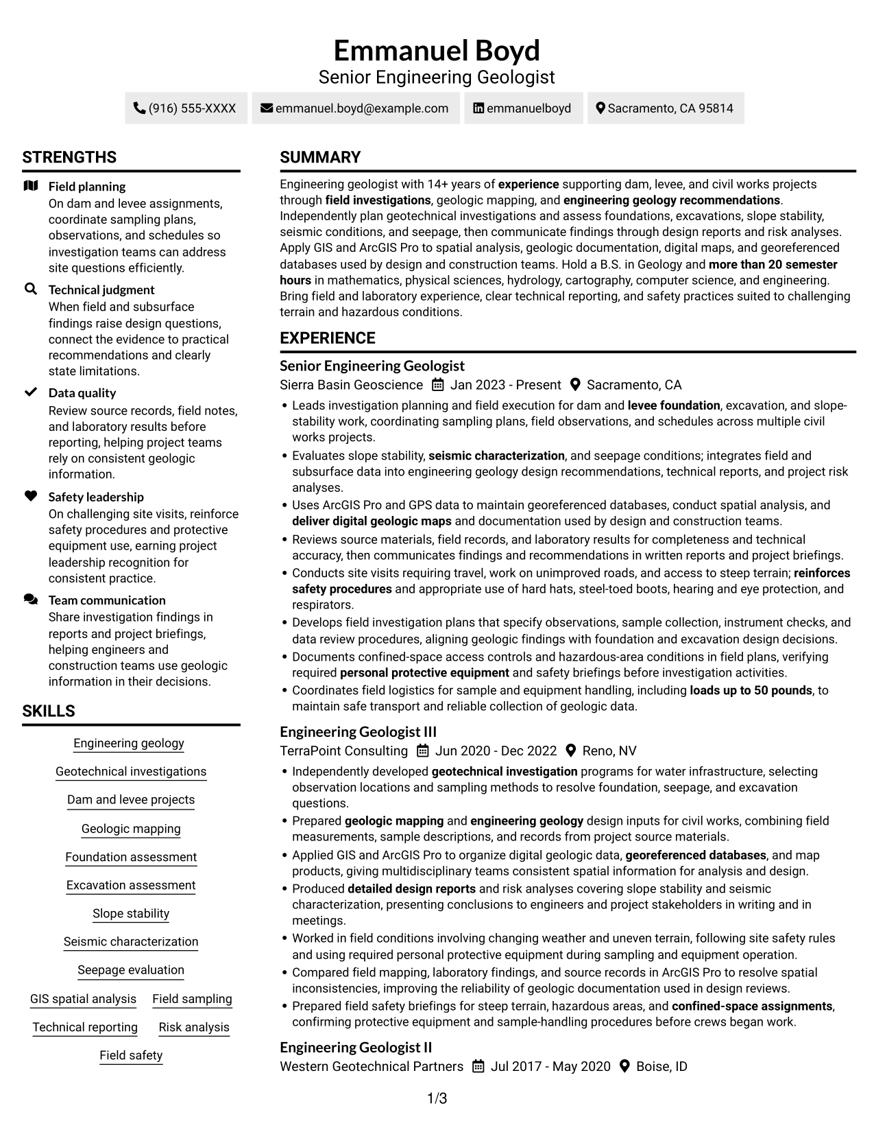
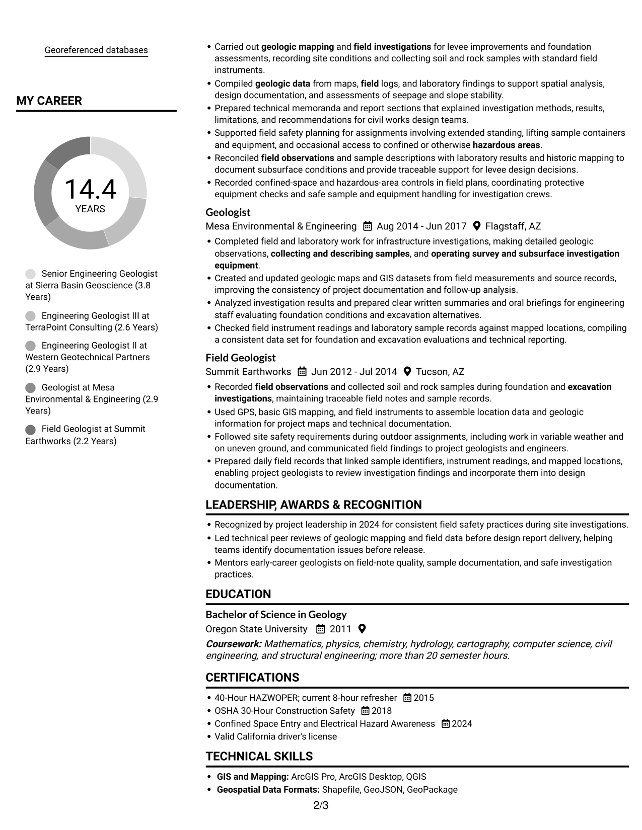
 
Resume example — page 1   Resume example — page 2

Why This Format Works

  • Parallel content areas let reviewers move between experience and supporting sections efficiently.
  • The two-column body gives skills and career history distinct reading areas.
  • Education and credentials can be located without scanning one long content stream.

Best For

  • Side-by-side section review
  • Resumes with several content areas
  • Quick movement between resume sections
  • Skills and experience in parallel
  • Compact content organization

#3 Plain One Column with Shaded Labels Resume Example

Plain One Column with Shaded Labels uses a single-column body, giving readers one clear path through the resume sections.
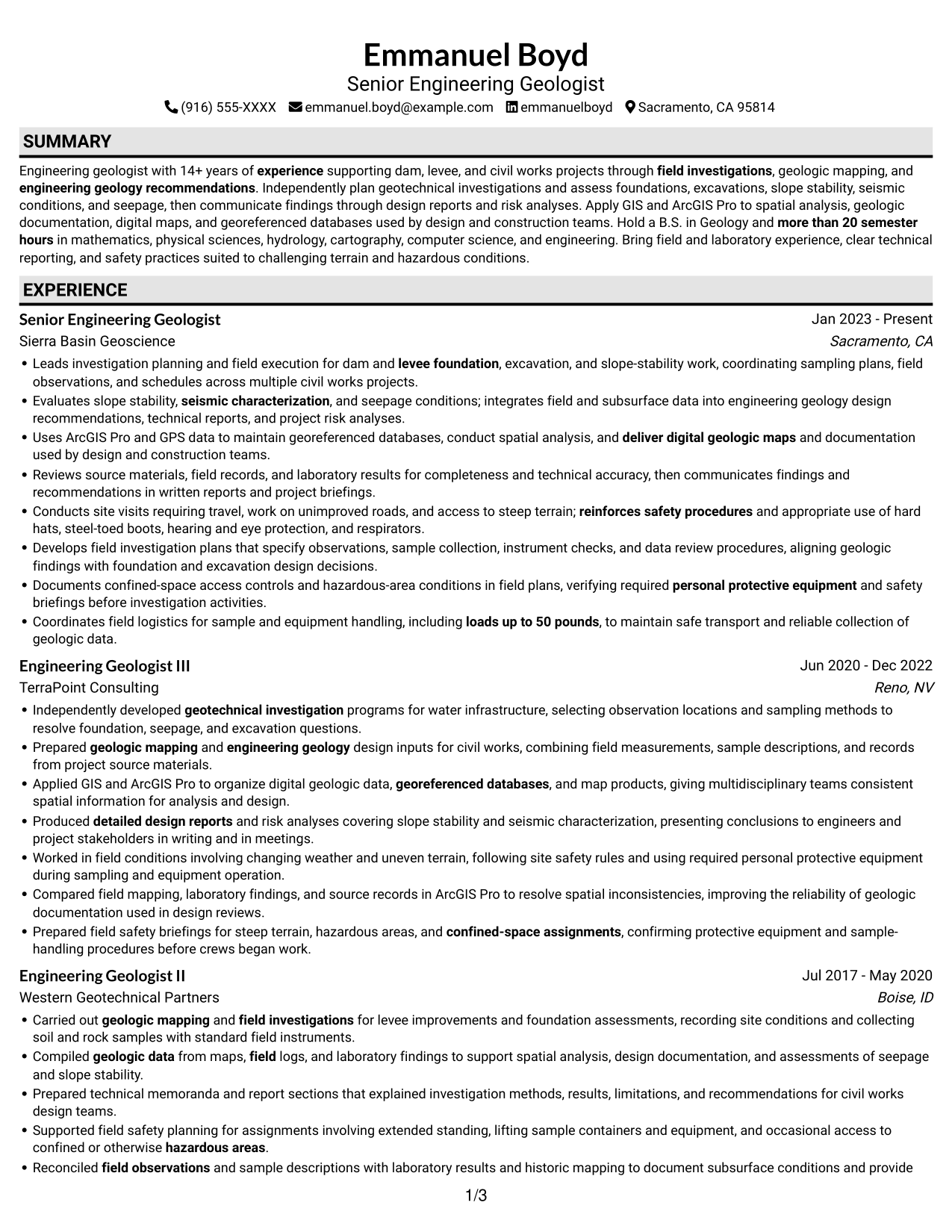
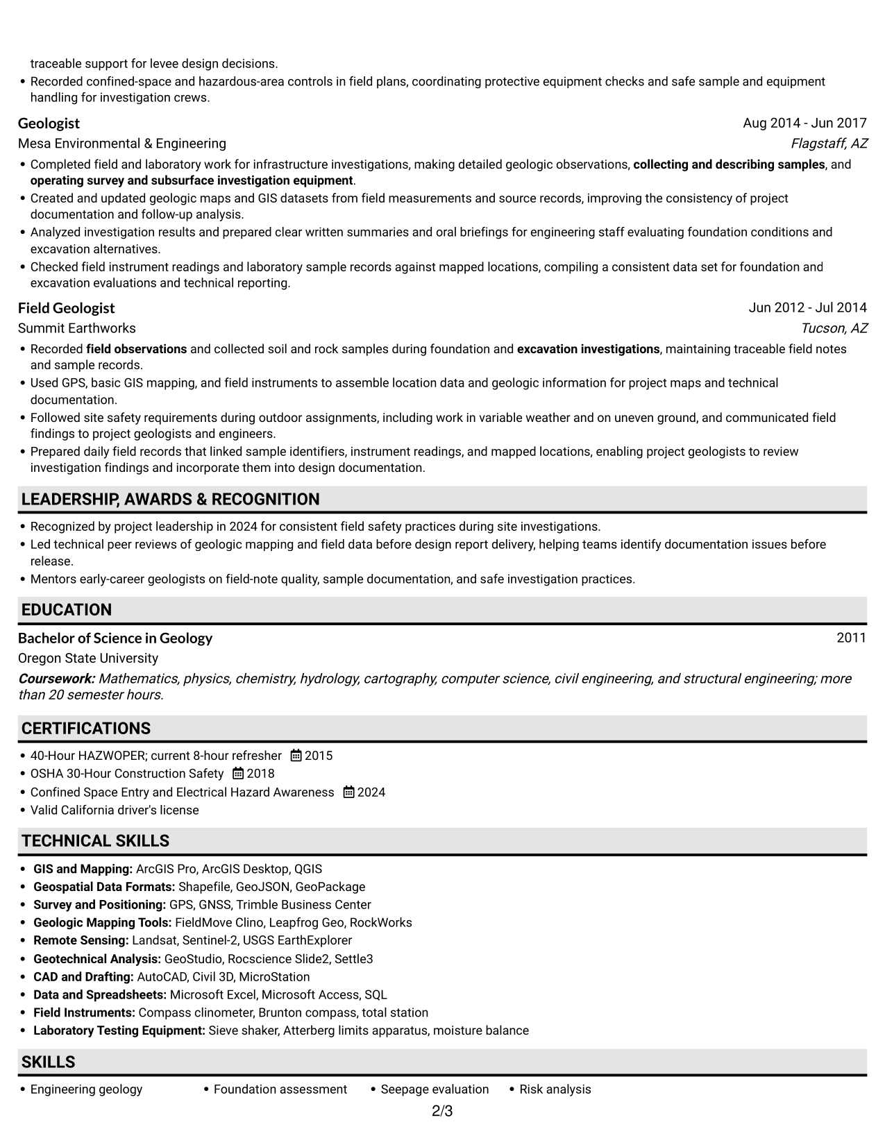
 
Resume example — page 1   Resume example — page 2

Why This Format Works

  • The single-column sequence helps reviewers trace experience from one role to the next.
  • Related experience details stay together within each part of the reading path.
  • Skills and education follow the same direct route through the document.

Best For

  • One-path resume reading
  • Career history in sequence
  • Detailed role descriptions
  • Direct section-by-section review
  • Single-column text preference
 

#4 One Column Format with Photo Right Resume Example

One Column Format with Photo Right pairs a right-side photo with a single-column body, keeping the resume text in one reading path.
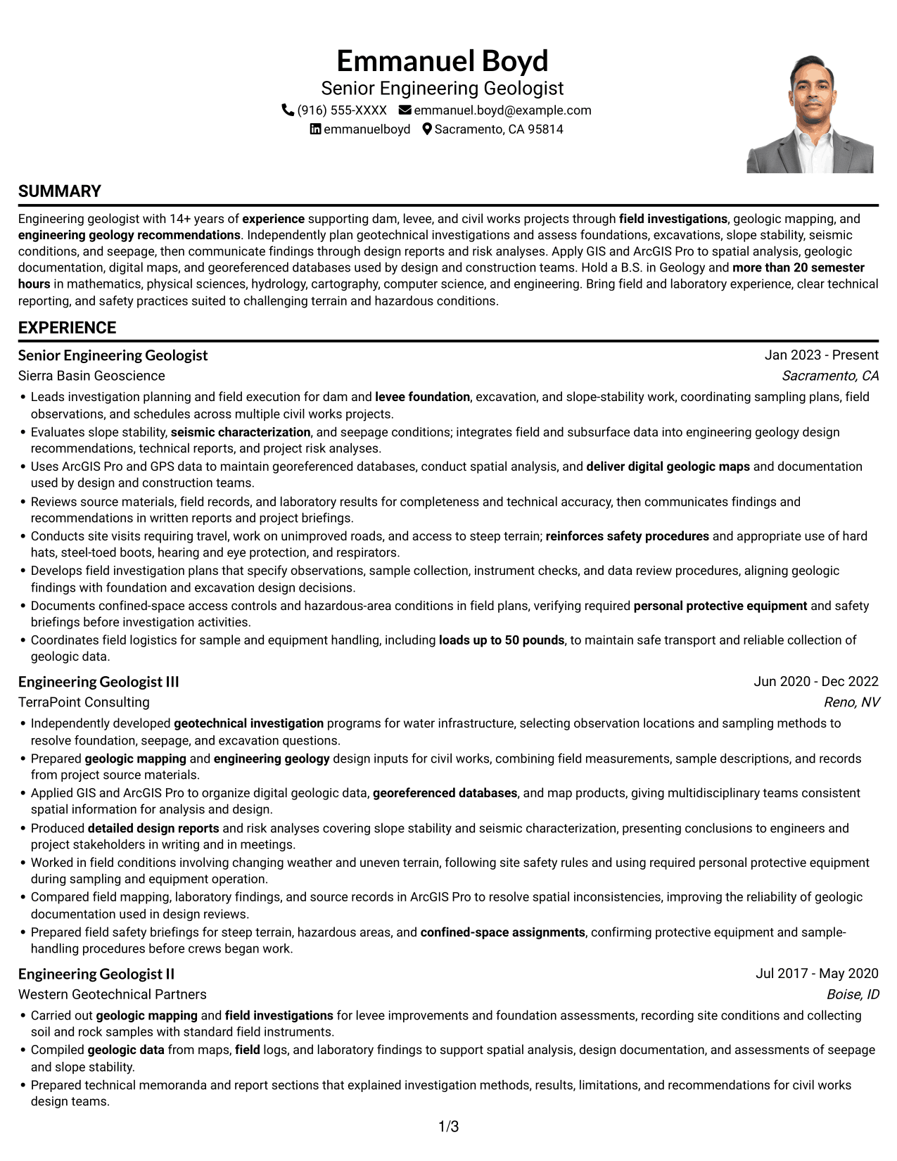
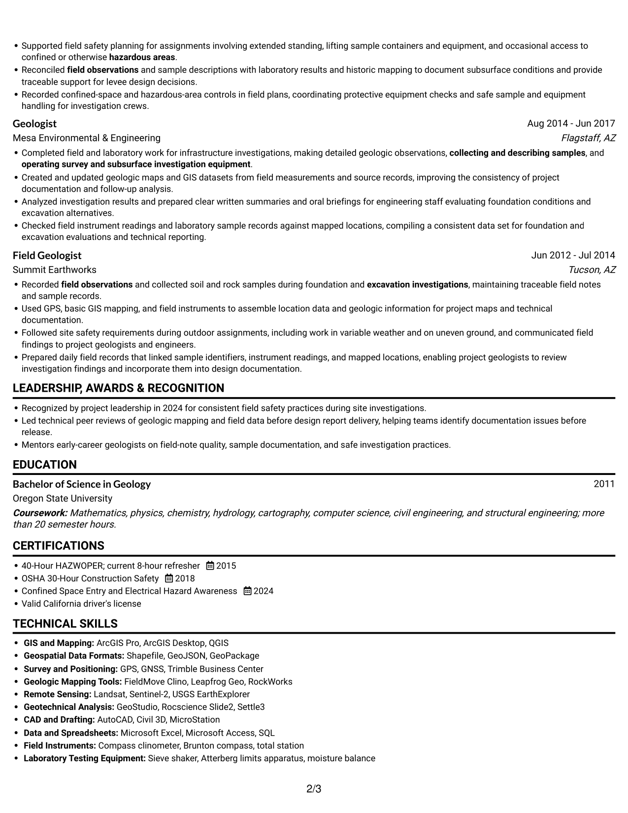
 
Resume example — page 1   Resume example — page 2

Why This Format Works

  • The single body column keeps career progression in a clear sequence.
  • A right-side portrait adds a visual point of reference without splitting the text.
  • Experience details remain together as reviewers move through the document.

Best For

  • Right-side portrait preference
  • Single-column resume reading
  • Career records in sequence
  • Detailed work history
  • Text kept in one flow
 

#5 Clean Two Column Sidebar Format Resume Example

Clean Two Column Sidebar Format presents resume content in two columns, making it easier to scan separate parts of the document side by side.
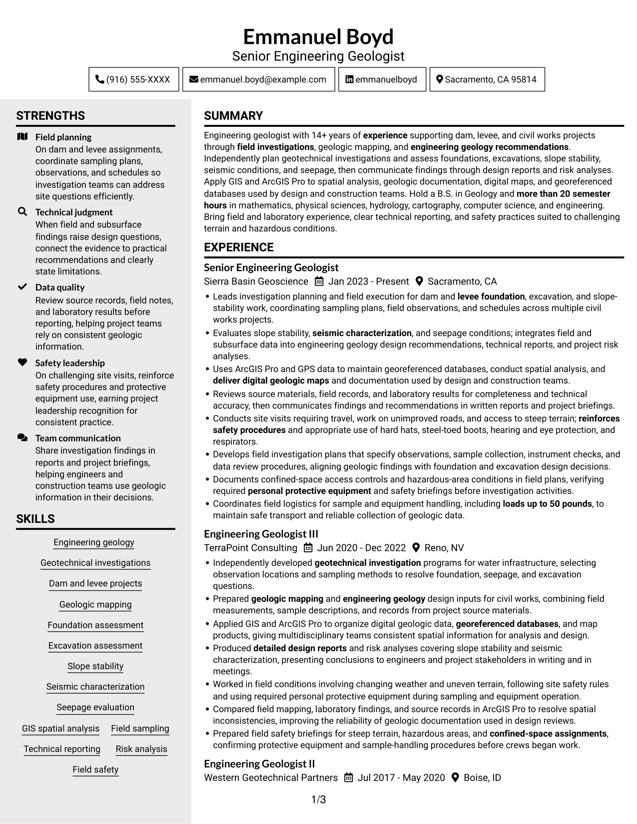
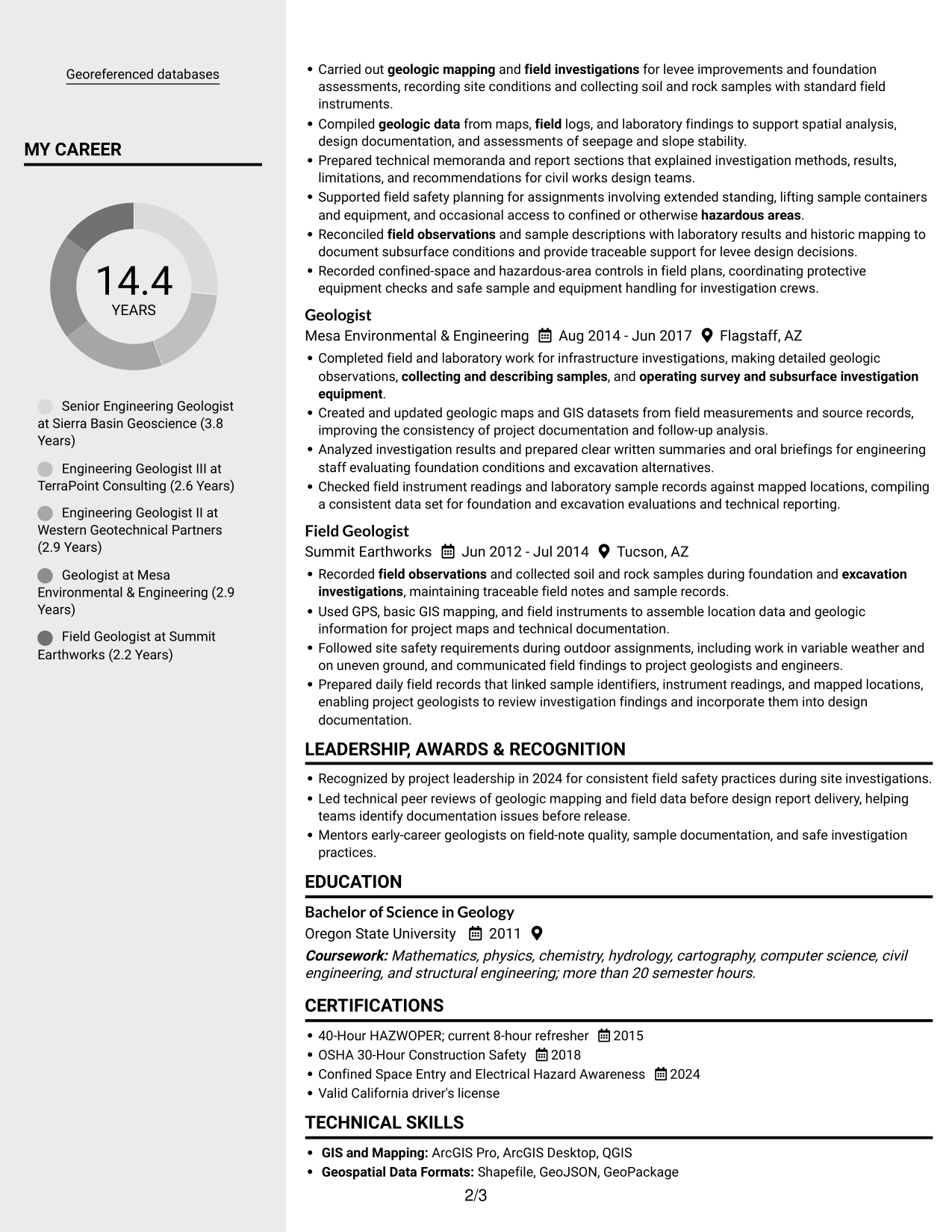
 
Resume example — page 1   Resume example — page 2

Why This Format Works

  • Two-column organization gives reviewers separate areas for scanning resume content.
  • Career history and supporting sections can be reviewed without one long vertical search.
  • The side-by-side reading arrangement suits resumes with several distinct sections.

Best For

  • Side-by-side content review
  • Several resume sections
  • Separate areas for resume details
  • Frequent section cross-checking
  • Two-column reading preference


#6 Two Column Format Resume Example

Two Column Format places resume content in two parallel columns, a useful arrangement for readers who want to review separate sections together.
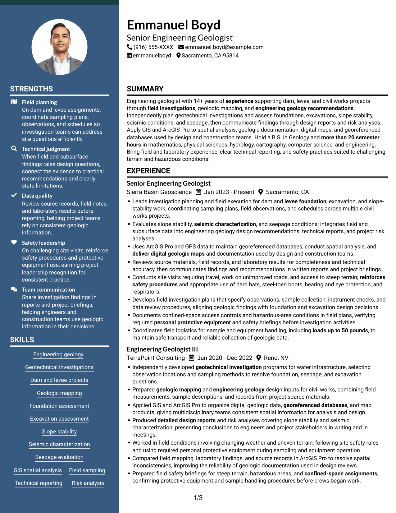
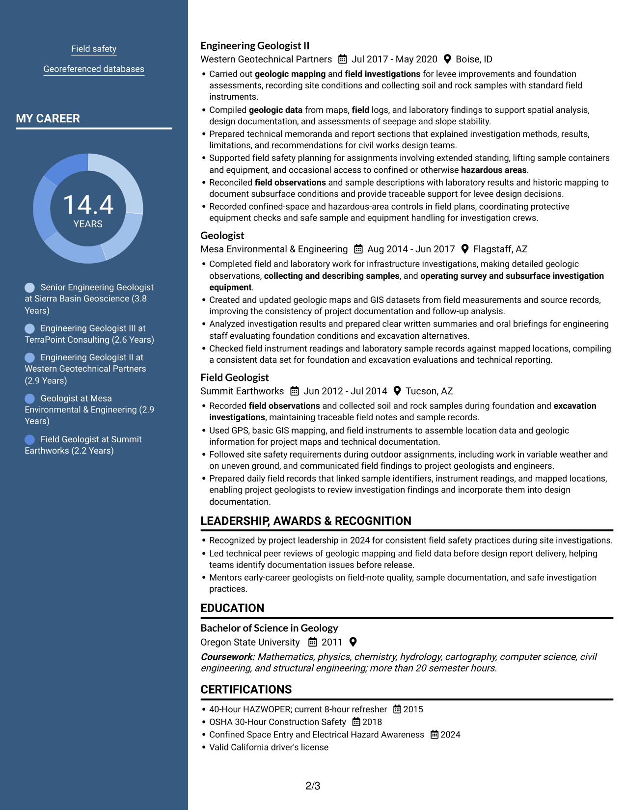
 
Resume example — page 1   Resume example — page 2

Why This Format Works

  • The parallel layout lets reviewers shift between career history and other resume sections.
  • Experience and supporting information occupy distinct areas for easy reference.
  • A two-column body reduces the need to scan one continuous vertical list.

Best For

  • Parallel resume sections
  • Side-by-side information review
  • Career history with supporting details
  • Quick section reference
  • Multiple resume content areas
 

#7 Photo Header Two Column Format Resume Example

Photo Header Two Column Format combines a header photo with a two-column body, pairing a visible portrait with side-by-side resume content.
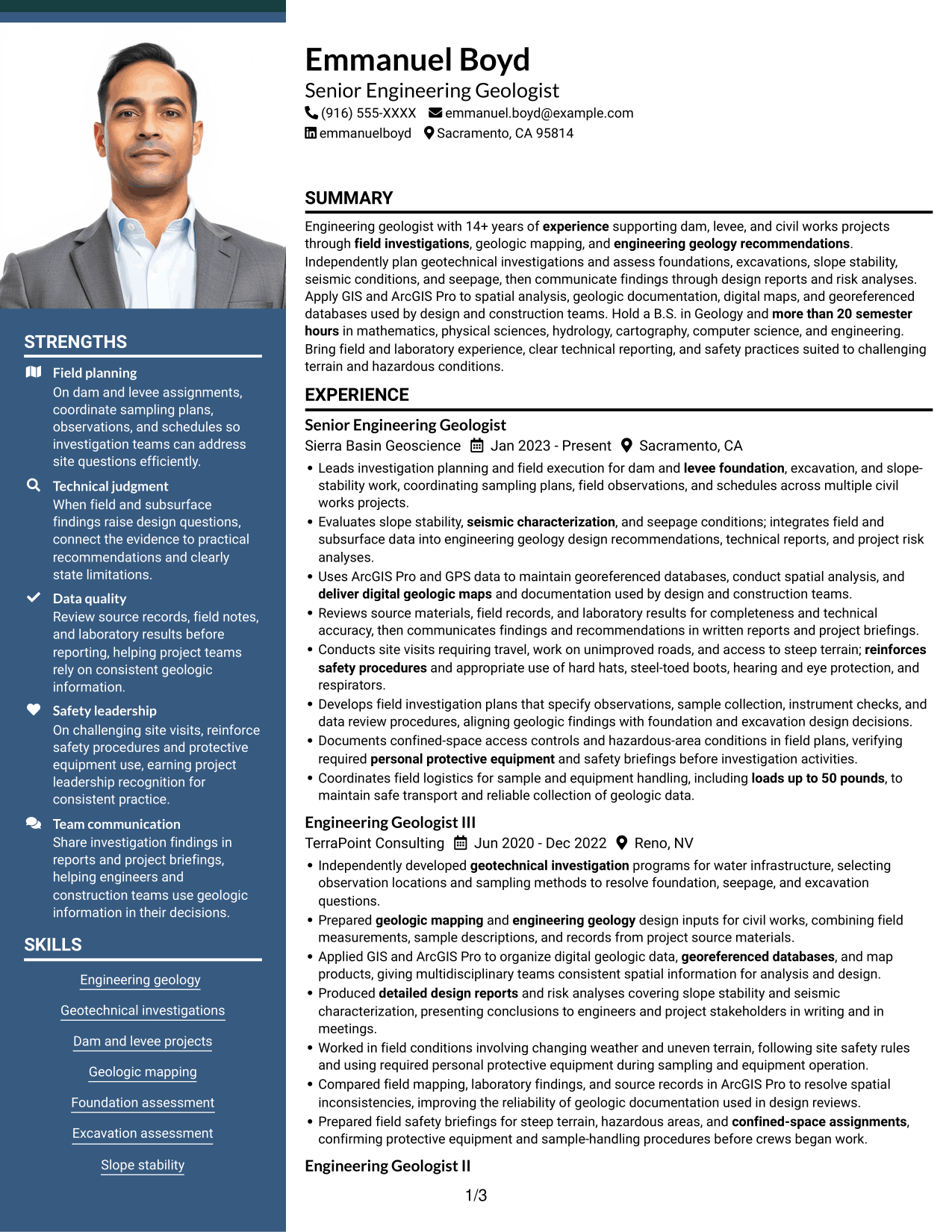
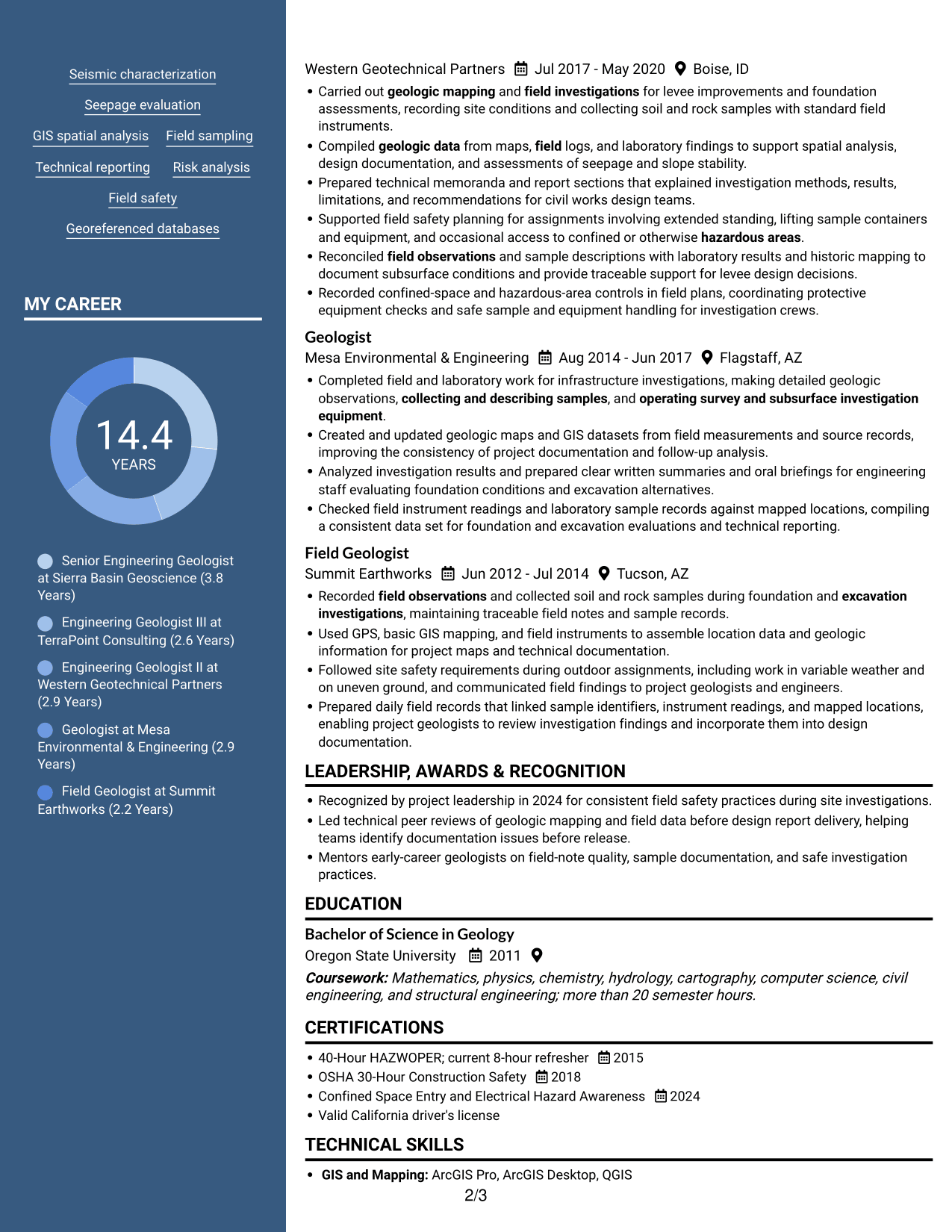
 
Resume example — page 1   Resume example — page 2

Why This Format Works

  • The two-column body gives resume sections parallel areas for review.
  • A photo in the header adds a visual element apart from the body text.
  • Reviewers can move between experience and supporting sections without following one long column.

Best For

  • Header photo preference
  • Two-column resume reading
  • Parallel section review
  • Experience with supporting details
  • Separate body content areas


Why Build Your Engineering Geologist - Dam and Levee Projects Resume with ResumeInMinutes

ResumeInMinutes lets you review a resume example and focus on the details that matter for engineering geology work. Compare the PNG image preview with the editor version as you organize your experience, skills, education, and certifications.

  • ATS-friendly section structure
  • Clear organization for field experience
  • Space for technical skills and tools
  • Focused experience bullet points
  • Easy-to-review image previews
  • Options to view and customize in the editor

Highlight the work you have done in field investigations, mapping, data review, and technical reporting. Keep each section clear, accurate, and easy to scan.


See Also


Frequently Asked Questions

Are these Engineering Geologist - Dam and Levee Projects resume templates ATS-friendly?

The resume examples use clear headings and organized sections that support quick review. Include relevant terms such as geotechnical investigations, geologic mapping, GIS spatial analysis, slope stability, and design reports when they accurately describe your experience.

What does this resume example show?

It shows one Engineering Geologist - Dam and Levee Projects resume in different layouts. The PNG previews help you compare the designs, and the editor link opens an example for review and customization.

What should an Engineering Geologist - Dam and Levee Projects resume include?

Include a clear summary, relevant experience, education, technical skills, and applicable certifications. Use bullet points to explain investigation planning, sample collection, geologic mapping, GIS work, design recommendations, and technical reports.

Which resume layout works well for this role?

Choose a clean layout with readable headings and a clear order for experience, skills, and education. A simple structure helps readers find technical details and makes the resume easier to scan.

Which skills and tools can I highlight?

List skills you can support with examples, such as geotechnical investigations, foundation assessment, slope stability, seepage evaluation, GIS, and ArcGIS Pro. Include relevant mapping, survey, analysis, or field tools only when you have used them.

Should I include a photo on my resume?

For U.S. applications, a resume without a photo is generally the safer choice. Use a photo only when it is customary or required in your location or field.

ATS Score 95%

How we calculate this score

  • Keywords: 60% of the total. AI extracts keywords from your job description. If you do not provide one, a standard job description for the title matching your resume is used. This is not a match to a specific vacancy.
  • Text-based resume: 20%. The text resume assessed here receives 100 for this part.
  • Resume quality: 20%. We start at 100 and subtract points for issues found by our resume checks, down to a minimum of zero.
  • Keyword coverage = round(100 × confirmed matches ÷ total keywords). Exact matches and supported equivalents verified by AI receive full credit; unsupported keywords receive none. Live text checks use the saved equivalents and do not request a new AI review. Without keywords, no overall ATS score is available.
  • Final score = 60% of keyword coverage + 20% of the text score + 20% of the quality score, rounded to a whole number. Without keywords, no overall ATS score is available.

What this score means

Our scores are estimates, not employer ratings. They may contain errors and do not guarantee accurate parsing, a ranking, an interview, or a job. Check your document against the employer’s requirements. You are responsible for relying on this score.

Terms and Conditions

Score weights: Keywords 60% · Text based resume 20% · Resume quality 20%

Keyword coverage: 31 of 34 (91%) · Resume quality: 100%

Resume quality 100% · Weight 20% · Issues (0)

Details
  • ✓Name present: Emmanuel Boyd
  • ✓Email format: emmanuel.boyd@example.com
  • ✓Phone format: (916) 555-XXXX
  • ✓Experience 1: Job title: Senior Engineering Geologist
  • ✓Experience 1: Company name: Sierra Basin Geoscience
  • ✓Experience 1: Work location: Sacramento, CA
  • ✓Experience 1: Employment dates: Jan 2023 - Present
  • ✓Experience 1: Description or achievements: Present
  • ✓Experience 2: Job title: Engineering Geologist III
  • ✓Experience 2: Company name: TerraPoint Consulting
  • ✓Experience 2: Work location: Reno, NV
  • ✓Experience 2: Employment dates: Jun 2020 - Dec 2022
  • ✓Experience 2: Description or achievements: Present
  • ✓Experience 3: Job title: Engineering Geologist II
  • ✓Experience 3: Company name: Western Geotechnical Partners
  • ✓Experience 3: Work location: Boise, ID
  • ✓Experience 3: Employment dates: Jul 2017 - May 2020
  • ✓Experience 3: Description or achievements: Present
  • ✓Experience 4: Job title: Geologist
  • ✓Experience 4: Company name: Mesa Environmental & Engineering
  • ✓Experience 4: Work location: Flagstaff, AZ
  • ✓Experience 4: Employment dates: Aug 2014 - Jun 2017
  • ✓Experience 4: Description or achievements: Present
  • ✓Experience 5: Job title: Field Geologist
  • ✓Experience 5: Company name: Summit Earthworks
  • ✓Experience 5: Work location: Tucson, AZ
  • ✓Experience 5: Employment dates: Jun 2012 - Jul 2014
  • ✓Experience 5: Description or achievements: Present
  • ✓No placeholder fields
  • ✓No repeated achievement bullets
  • ✓No empty bullets

No issues found by the current checks.

Text Based Resume 100% · Weight 20%

Parsed text
Emmanuel Boyd
(916) 555-XXXX
emmanuel.boyd@example.com
emmanuelboyd
Sacramento, CA 95814
SUMMARY
Engineering geologist with 14+ years of experience supporting dam, levee, and civil works projects through field investigations, geologic mapping, and engineering geology recommendations. Independently plan geotechnical investigations and assess foundations, excavations, slope stability, seismic conditions, and seepage, then communicate findings through design reports and risk analyses. Apply GIS and ArcGIS Pro to spatial analysis, geologic documentation, digital maps, and georeferenced databases used by design and construction teams. Hold a B.S. in Geology and more than 20 semester hours in mathematics, physical sciences, hydrology, cartography, computer science, and engineering. Bring field and laboratory experience, clear technical reporting, and safety practices suited to challenging terrain and hazardous conditions.
EXPERIENCE
Senior Engineering Geologist
Jan 2023 - Present
Sierra Basin Geoscience
Sacramento, CA
Leads investigation planning and field execution for dam and levee foundation, excavation, and slope-stability work, coordinating sampling plans, field observations, and schedules across multiple civil works projects.
Evaluates slope stability, seismic characterization, and seepage conditions; integrates field and subsurface data into engineering geology design recommendations, technical reports, and project risk analyses.
Uses ArcGIS Pro and GPS data to maintain georeferenced databases, conduct spatial analysis, and deliver digital geologic maps and documentation used by design and construction teams.
Reviews source materials, field records, and laboratory results for completeness and technical accuracy, then communicates findings and recommendations in written reports and project briefings.
Conducts site visits requiring travel, work on unimproved roads, and access to steep terrain; reinforces safety procedures and appropriate use of hard hats, steel-toed boots, hearing and eye protection, and respirators.
Develops field investigation plans that specify observations, sample collection, instrument checks, and data review procedures, aligning geologic findings with foundation and excavation design decisions.
Documents confined-space access controls and hazardous-area conditions in field plans, verifying required personal protective equipment and safety briefings before investigation activities.
Coordinates field logistics for sample and equipment handling, including loads up to 50 pounds, to maintain safe transport and reliable collection of geologic data.
Engineering Geologist III
Jun 2020 - Dec 2022
TerraPoint Consulting
Reno, NV
Independently developed geotechnical investigation programs for water infrastructure, selecting observation locations and sampling methods to resolve foundation, seepage, and excavation questions.
Prepared geologic mapping and engineering geology design inputs for civil works, combining field measurements, sample descriptions, and records from project source materials.
Applied GIS and ArcGIS Pro to organize digital geologic data, georeferenced databases, and map products, giving multidisciplinary teams consistent spatial information for analysis and design.
Produced detailed design reports and risk analyses covering slope stability and seismic characterization, presenting conclusions to engineers and project stakeholders in writing and in meetings.
Worked in field conditions involving changing weather and uneven terrain, following site safety rules and using required personal protective equipment during sampling and equipment operation.
Compared field mapping, laboratory findings, and source records in ArcGIS Pro to resolve spatial inconsistencies, improving the reliability of geologic documentation used in design reviews.
Prepared field safety briefings for steep terrain, hazardous areas, and confined-space assignments, confirming protective equipment and sample-handling procedures before crews began work.
Engineering Geologist II
Jul 2017 - May 2020
Western Geotechnical Partners
Boise, ID
Carried out geologic mapping and field investigations for levee improvements and foundation assessments, recording site conditions and collecting soil and rock samples with standard field instruments.
Compiled geologic data from maps, field logs, and laboratory findings to support spatial analysis, design documentation, and assessments of seepage and slope stability.
Prepared technical memoranda and report sections that explained investigation methods, results, limitations, and recommendations for civil works design teams.
Supported field safety planning for assignments involving extended standing, lifting sample containers and equipment, and occasional access to confined or otherwise hazardous areas.
Reconciled field observations and sample descriptions with laboratory results and historic mapping to document subsurface conditions and provide traceable support for levee design decisions.
Recorded confined-space and hazardous-area controls in field plans, coordinating protective equipment checks and safe sample and equipment handling for investigation crews.
Geologist
Aug 2014 - Jun 2017
Mesa Environmental & Engineering
Flagstaff, AZ
Completed field and laboratory work for infrastructure investigations, making detailed geologic observations, collecting and describing samples, and operating survey and subsurface investigation equipment.
Created and updated geologic maps and GIS datasets from field measurements and source records, improving the consistency of project documentation and follow-up analysis.
Analyzed investigation results and prepared clear written summaries and oral briefings for engineering staff evaluating foundation conditions and excavation alternatives.
Checked field instrument readings and laboratory sample records against mapped locations, compiling a consistent data set for foundation and excavation evaluations and technical reporting.
Field Geologist
Jun 2012 - Jul 2014
Summit Earthworks
Tucson, AZ
Recorded field observations and collected soil and rock samples during foundation and excavation investigations, maintaining traceable field notes and sample records.
Used GPS, basic GIS mapping, and field instruments to assemble location data and geologic information for project maps and technical documentation.
Followed site safety requirements during outdoor assignments, including work in variable weather and on uneven ground, and communicated field findings to project geologists and engineers.
Prepared daily field records that linked sample identifiers, instrument readings, and mapped locations, enabling project geologists to review investigation findings and incorporate them into design documentation.
LEADERSHIP, AWARDS & RECOGNITION
Recognized by project leadership in 2024 for consistent field safety practices during site investigations.
Led technical peer reviews of geologic mapping and field data before design report delivery, helping teams identify documentation issues before release.
Mentors early-career geologists on field-note quality, sample documentation, and safe investigation practices.
EDUCATION
Bachelor of Science in Geology
2011
Oregon State University
Coursework: Mathematics, physics, chemistry, hydrology, cartography, computer science, civil engineering, and structural engineering; more than 20 semester hours.
CERTIFICATIONS
40-Hour HAZWOPER; current 8-hour refresher
2015
OSHA 30-Hour Construction Safety
2018
Confined Space Entry and Electrical Hazard Awareness
2024
Valid California driver's license
TECHNICAL SKILLS
GIS and Mapping: ArcGIS Pro, ArcGIS Desktop, QGIS
Geospatial Data Formats: Shapefile, GeoJSON, GeoPackage
Survey and Positioning: GPS, GNSS, Trimble Business Center
Geologic Mapping Tools: FieldMove Clino, Leapfrog Geo, RockWorks
Remote Sensing: Landsat, Sentinel-2, USGS EarthExplorer
Geotechnical Analysis: GeoStudio, Rocscience Slide2, Settle3
CAD and Drafting: AutoCAD, Civil 3D, MicroStation
Data and Spreadsheets: Microsoft Excel, Microsoft Access, SQL
Field Instruments: Compass clinometer, Brunton compass, total station
Laboratory Testing Equipment: Sieve shaker, Atterberg limits apparatus, moisture balance
SKILLS
Engineering geology
Geotechnical investigations
Dam and levee projects
Geologic mapping
Foundation assessment
Excavation assessment
Slope stability
Seismic characterization
Seepage evaluation
GIS spatial analysis
Field sampling
Technical reporting
Risk analysis
Field safety
Georeferenced databases
PROFESSIONAL AFFILIATIONS
Member, Geological Society of America, supporting professional engagement in geology and geoscience.
Member, Association of Engineering Geologists, engaging with professionals in applied geology and engineering projects.

Matched keywords (31)

  • Bachelor of Science in GeologyOriginal keyword in JD: Bachelor's degree or higher in Geology
  • more than 20 semester hoursOriginal keyword in JD: 20 semester hours in qualifying coursework
  • 14+ years of experience supporting dam, levee, and civil works projectsOriginal keyword in JD: 1+ year of specialized experience
  • Independently developed geotechnical investigation programs for water infrastructure, selecting observation locations and sampling methods to resolve foundation, seepage, and excavation questions.Original keyword in JD: Independent planning and execution of geotechnical investigations
  • geologic mapping
  • Prepared geologic mapping and engineering geology design inputs for civil worksOriginal keyword in JD: Engineering geology designs for civil works projects
  • Apply GIS and ArcGIS Pro to spatial analysis, geologic documentationOriginal keyword in JD: GIS spatial analysis and geologic documentation
  • Dam and levee projects
  • field investigations
  • Leads investigation planning and field execution for dam and levee foundationOriginal keyword in JD: Foundation investigations
  • excavation investigations
  • Evaluates slope stabilityOriginal keyword in JD: Slope stability analysis
  • seismic characterization
  • Seepage evaluation
  • engineering geology recommendationsOriginal keyword in JD: Geotechnical and geological principles
  • detailed design reports
  • risk analyses
  • deliver digital geologic mapsOriginal keyword in JD: Digital mapping products
  • georeferenced databases
  • field observations
  • collecting and describing samplesOriginal keyword in JD: Geological sample collection
  • operating survey and subsurface investigation equipmentOriginal keyword in JD: Field and laboratory instruments
  • Compiled geologic data from maps, field logs, and laboratory findingsOriginal keyword in JD: Geologic data compilation from source materials
  • presenting conclusions to engineers and project stakeholders in writing and in meetings.Original keyword in JD: Oral and written technical reporting
  • Completed field and laboratory work for infrastructure investigationsOriginal keyword in JD: Field and laboratory geological work
  • reinforces safety proceduresOriginal keyword in JD: Field safety procedures
  • personal protective equipment
  • hazardous areasOriginal keyword in JD: Hazardous-area awareness
  • confined-space assignmentsOriginal keyword in JD: Confined-space safety
  • loads up to 50 poundsOriginal keyword in JD: Lifting up to 50 pounds
  • Valid California driver's licenseOriginal keyword in JD: Valid state driver's license

Missing keywords (3)

  • U.S. citizenship
  • 52 weeks of federal service at GS-11 or equivalent, when applicable
  • Suitability or fitness determination
Disclaimer: All names, images, contact information, employment histories, achievements, security clearances, military credentials, and other qualifications shown in this content are fictional and used for illustrative purposes only. Any resemblance to actual persons, living or deceased, is purely coincidental.

Resume and cover-letter examples and recommendations in this article reflect general best practices and professional experience and are provided for guidance only. Results may vary based on role, industry, region, and hiring organization.

Content Accuracy and Verification: To the fullest extent permitted by applicable law, we do not represent or warrant that resume or cover-letter guidance, examples, recommendations, or related information are accurate, complete, current, error-free, or suitable for any particular purpose. You are responsible for independently reviewing and verifying the information before relying on it.

ATS and Cover-Letter Scores: ATS scores are estimates calculated using our own formula, informed by publicly available guidance on resume formatting and keyword matching. They are not scores issued or endorsed by an ATS provider or employer. Cover-letter scores are also our own assessments. Parsing, weighting, screening criteria, and results vary between systems, employers, job descriptions, and document formats. No score guarantees successful parsing, a particular ranking, an interview, or employment. Use scores as general guidance and independently check your documents against the employer’s requirements. To the fullest extent permitted by applicable law, we accept no liability for errors in scores or parsing, or losses arising from reliance on these assessments. Nothing in this notice excludes liability or limits consumer rights that cannot lawfully be excluded or limited.

Terms and Conditions
 
> JP 1 1
PDF Footer and Margins Setup
The margins are applied to the document, and the footer shows up in the preview and the PDF

Footer Font Settings

Are you applying for a specific job
so we can tailor your resume to it?
Are you applying for a specific job
so we can tailor your cover letter to it?

Your data stays private and is never used for training.Privacy Policy

Type your details as text to generate a personalized resume Type your details as text to generate a personalized cover letter
Website link found! Ready to create resume from:

Your data stays private and is never used for training.Privacy Policy

Drag the into the box to verify you're human.
Drop here

My Resumes

Displaying {number_of_files} files (out of {total_of_all_files} total)
Name File Type Last Modified: Description:

Rename File

Filename already exists!

Delete Files

Warning: This action is irreversible. Once you click submit, the files will be permanently deleted.

Heading text
Upload From Computer Upload
Select From Existing
LinkedIn
Drag & Drop files anywhere in this tab, or

Uploaded Files

Delete Name Last Updated Use This File
Select this to use the file for generating your resume and cover letter. Only one source—uploaded file, selected file, or LinkedIn text—can be used.

My Files

Resumes or cover letters you create will appear here. No files available yet.
Delete Name Last Updated Use This File
Select this to use the file for generating your resume and cover letter. Only one source—uploaded file, selected file, or LinkedIn text—can be used.

Add LinkedIn Profile PDF

You can download your LinkedIn profile as a PDF by opening linkedin.com in a web browser, clicking your profile photo, selecting the “More” or “Resources” button, and choosing “Save to PDF.” You can then attach the PDF using the Upload From Computer tab.

Paste Your LinkedIn Profile Text

If you have copied the LinkedIn profile text, paste it below. See how to copy your profile from LinkedIn

Select this to use the LinkedIn profile text for generating your resume and cover letter. Only one source—uploaded file, selected file, or LinkedIn text—can be used.

Try these controls

<
>